
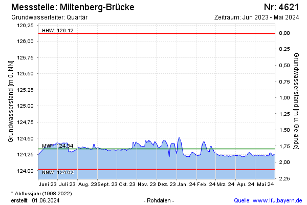
Current data Miltenberg-Brücke
note
Datenfernübertragung ist ausgefallen. Daten werden 3-monatlich ausgelesen.
Groundwater level [m above sealevel]: 124.28
Distance to surface [m]: 1.85
Last value from 28.05.2026 09:00
Ground level [m above sealevel]: 126.13
| Date | Groundwater level [m above sealevel] |
|---|---|
| 28.05.2026 | 124.28 |
| 27.05.2026 | 124.29 |
| 26.05.2026 | 124.28 |
| 25.05.2026 | 124.28 |
| 24.05.2026 | 124.29 |
| 23.05.2026 | 124.29 |
| 22.05.2026 | 124.29 |
| 21.05.2026 | 124.29 |