
- Start >
- Groundwater >
- Waterlevel of upper layer >
- Unterer Main >
- LOHR A. MAIN/FARBMUEH. >
- Chart of total period

Chart of total period LOHR A. MAIN/FARBMUEH.
Groundwater levels of the total period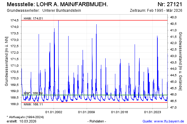
Groundwater level [m above sealevel]: 168.46
Distance to surface [m]: 46.28
Last value from 23.01.2026 10:00
Ground level [m above sealevel]: 214.74
| Date | Groundwater level [m above sealevel] |
|---|---|
| 23.01.2026 | 168.46 |
| 22.01.2026 | 168.47 |
| 21.01.2026 | 168.47 |
| 20.01.2026 | 168.49 |
| 19.01.2026 | 168.51 |
| 18.01.2026 | 168.54 |
| 17.01.2026 | 168.54 |
| 16.01.2026 | 168.51 |
© Bayerisches Landesamt für Umwelt 2026