
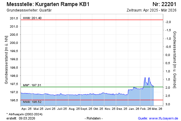
Current data Kurgarten Rampe KB1
Groundwater level [m above sealevel]: 197.11
Distance to surface [m]: 2.16
Last value from 14.07.2026 10:00
Ground level [m above sealevel]: 199.27
| Date | Groundwater level [m above sealevel] |
|---|---|
| 14.07.2026 | 197.12 |
| 13.07.2026 | 197.12 |
| 12.07.2026 | 197.11 |
| 11.07.2026 | 197.12 |
| 10.07.2026 | 197.13 |
| 09.07.2026 | 197.13 |
| 08.07.2026 | 197.12 |
| 07.07.2026 | 197.15 |