
- Start >
- Groundwater >
- Waterlevel of upper layer >
- Unterer Main >
- Knetzgau ku 1 >
- Chart of total period

Chart of total period Knetzgau ku 1
Groundwater levels of the total period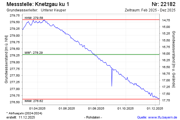
Groundwater level [m above sealevel]: 278.55
Distance to surface [m]: 15.77
Last value from 13.04.2026 09:00
Ground level [m above sealevel]: 294.32
| Date | Groundwater level [m above sealevel] |
|---|---|
| 13.04.2026 | 278.54 |
| 12.04.2026 | 278.52 |
| 11.04.2026 | 278.51 |
| 10.04.2026 | 278.48 |
| 09.04.2026 | 278.44 |
| 08.04.2026 | 278.39 |
| 07.04.2026 | 278.37 |
| 06.04.2026 | 278.34 |
© Bayerisches Landesamt für Umwelt 2026