
- Start >
- Groundwater >
- Waterlevel of upper layer >
- Unterer Main >
- KLEINOSTHEIM 13 >
- Chart of total period

Chart of total period KLEINOSTHEIM 13
Groundwater levels of the total period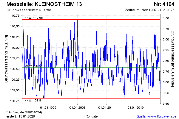
Groundwater level [m above sealevel]: 109.49
Distance to surface [m]: 2.70
Last value from 22.04.2026 14:00
Ground level [m above sealevel]: 112.19
| Date | Groundwater level [m above sealevel] |
|---|---|
| 22.04.2026 | 109.49 |
| 21.04.2026 | 109.50 |
| 20.04.2026 | 109.51 |
| 19.04.2026 | 109.51 |
| 18.04.2026 | 109.52 |
| 17.04.2026 | 109.52 |
| 16.04.2026 | 109.52 |
| 15.04.2026 | 109.53 |
© Bayerisches Landesamt für Umwelt 2026