
- Start >
- Groundwater >
- Waterlevel of upper layer >
- Unterer Main >
- Kerbfeld ku 1 >
- Chart of total period

Chart of total period Kerbfeld ku 1
Groundwater levels of the total period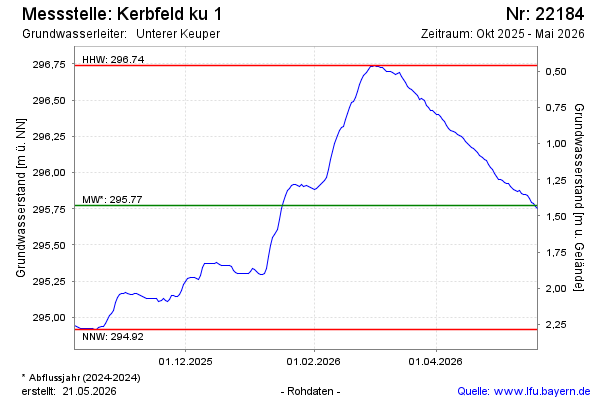
Groundwater level [m above sealevel]: 295.75
Distance to surface [m]: 1.45
Last value from 20.05.2026 09:00
Ground level [m above sealevel]: 297.20
| Date | Groundwater level [m above sealevel] |
|---|---|
| 20.05.2026 | 295.76 |
| 19.05.2026 | 295.76 |
| 18.05.2026 | 295.78 |
| 17.05.2026 | 295.80 |
| 16.05.2026 | 295.82 |
| 15.05.2026 | 295.84 |
| 14.05.2026 | 295.85 |
| 13.05.2026 | 295.85 |
© Bayerisches Landesamt für Umwelt 2026