
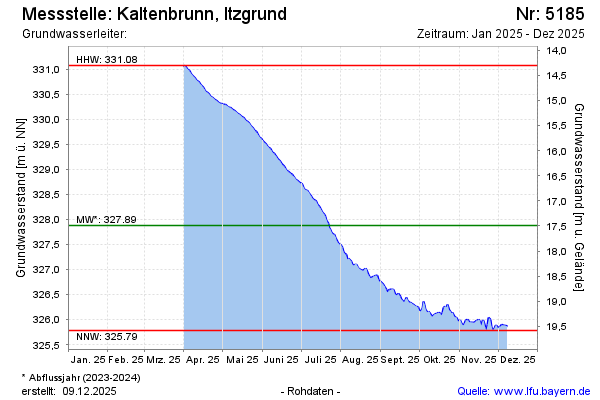
Current data Kaltenbrunn, Itzgrund
Groundwater level [m above sealevel]: 327.80
Distance to surface [m]: 17.57
Last value from 14.07.2026 06:00
Ground level [m above sealevel]: 345.37
| Date | Groundwater level [m above sealevel] |
|---|---|
| 14.07.2026 | 327.81 |
| 13.07.2026 | 327.82 |
| 12.07.2026 | 327.84 |
| 11.07.2026 | 327.91 |
| 10.07.2026 | 327.98 |
| 09.07.2026 | 328.02 |
| 08.07.2026 | 328.10 |
| 07.07.2026 | 328.18 |