
- Start >
- Groundwater >
- Waterlevel of upper layer >
- Unterer Main >
- Höchstadt Q 14 >
- Chart of total period

Chart of total period Höchstadt Q 14
Groundwater levels of the total period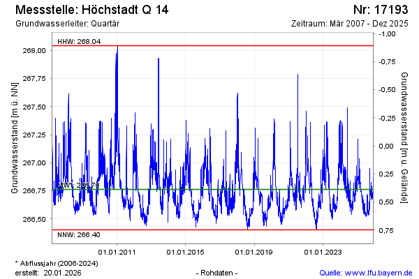
Groundwater level [m above sealevel]: 266.87
Distance to surface [m]: 0.28
Last value from 03.05.2024 15:00
Ground level [m above sealevel]: 267.15
| Date | Groundwater level [m above sealevel] |
|---|---|
| 02.05.2024 | 266.73 |
| 01.05.2024 | 266.74 |
| 30.04.2024 | 266.75 |
| 29.04.2024 | 266.77 |
| 28.04.2024 | 266.79 |
| 27.04.2024 | 266.82 |
| 26.04.2024 | 266.84 |
| 25.04.2024 | 266.86 |
© Bayerisches Landesamt für Umwelt 2024