
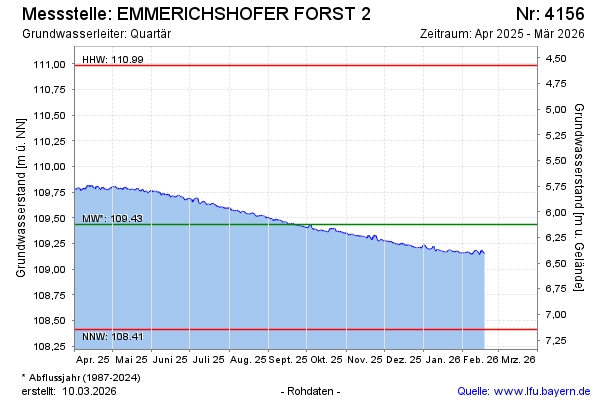
Current data EMMERICHSHOFER FORST 2
Groundwater level [m above sealevel]: 109.31
Distance to surface [m]: 6.25
Last value from 09.07.2026 13:00
Ground level [m above sealevel]: 115.56
| Date | Groundwater level [m above sealevel] |
|---|---|
| 09.07.2026 | 109.31 |
| 08.07.2026 | 109.31 |
| 07.07.2026 | 109.33 |
| 06.07.2026 | 109.32 |
| 05.07.2026 | 109.32 |
| 04.07.2026 | 109.32 |
| 03.07.2026 | 109.32 |
| 02.07.2026 | 109.33 |