
- Start >
- Groundwater >
- Waterlevel of upper layer >
- Unterer Main >
- BERGRHEINFELD 70 >
- Chart of total period

Chart of total period BERGRHEINFELD 70
Groundwater levels of the total period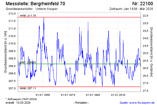
Groundwater level [m above sealevel]: 209.49
Distance to surface [m]: 24.82
Last value from 04.05.2024 10:00
Ground level [m above sealevel]: 234.31
| Date | Groundwater level [m above sealevel] |
|---|---|
| 04.05.2024 | 209.49 |
| 03.05.2024 | 209.49 |
| 02.05.2024 | 209.49 |
| 01.05.2024 | 209.49 |
| 30.04.2024 | 209.48 |
| 29.04.2024 | 209.48 |
| 28.04.2024 | 209.49 |
| 27.04.2024 | 209.49 |
© Bayerisches Landesamt für Umwelt 2024