
- Start >
- Groundwater >
- Waterlevel of upper layer >
- Obere Donau >
- WULLENSTETTEN 751 >
- Chart of total period

Chart of total period WULLENSTETTEN 751
Groundwater levels of the total period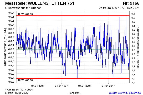
Groundwater level [m above sealevel]: 488.52
Distance to surface [m]: 1.96
Last value from 16.12.2025 13:32
Ground level [m above sealevel]: 490.48
| Date | Groundwater level [m above sealevel] |
|---|---|
| 16.12.2025 | 488.52 |
| 15.12.2025 | 488.53 |
| 14.12.2025 | 488.53 |
| 13.12.2025 | 488.53 |
| 12.12.2025 | 488.54 |
| 11.12.2025 | 488.54 |
| 10.12.2025 | 488.55 |
| 09.12.2025 | 488.55 |
© Bayerisches Landesamt für Umwelt 2026