
Chart of total period WOERNITZSTEIN W3
Groundwater level [m above sealevel]: 402,80
Distance to surface [m]: 1,66
Last value from 24.04.1978 12:00
Ground level [m above sealevel]: 404.46
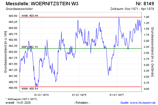
| Date | Groundwater level [m above sealevel] |
|---|---|
| 17.04.1978 | 402.81 |
| 10.04.1978 | 402.96 |
| 03.04.1978 | 403.12 |
| 27.03.1978 | 403.30 |
| 20.03.1978 | 403.08 |
| 13.03.1978 | 403.11 |
| 06.03.1978 | 403.34 |
| 27.02.1978 | 403.19 |