
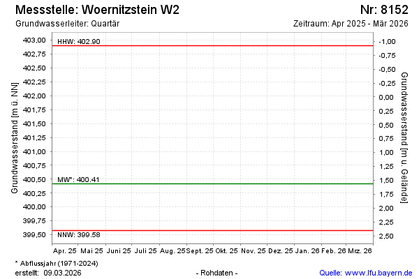
Current data WOERNITZSTEIN W2
Groundwater level [m above sealevel]: 400.35
Distance to surface [m]: 1.63
Last value from 18.11.2025 15:30
Ground level [m above sealevel]: 401.98
| Date | Groundwater level [m above sealevel] |
|---|---|
| 31.10.2024 | 400.30 |
| 06.03.2024 | 400.54 |
| 04.04.2023 | 400.57 |
| 07.07.2022 | 400.06 |
| 03.03.2021 | 400.47 |
| 20.02.2020 | 401.01 |
| 24.01.2019 | 400.81 |
| 23.01.2018 | 401.86 |