
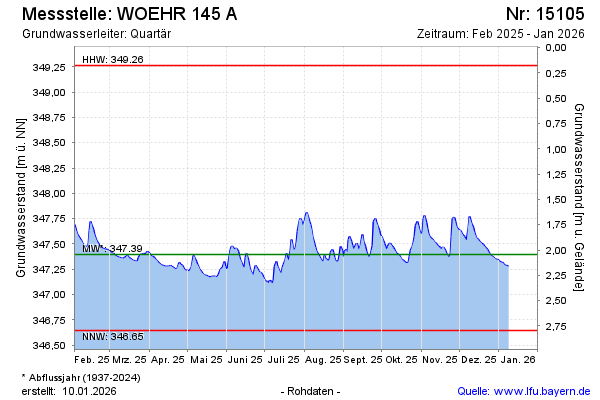
Current data WOEHR 145 A
Groundwater level [m above sealevel]: 347.04
Distance to surface [m]: 2.4
Last value from 13.07.2026 10:00
Ground level [m above sealevel]: 349.44
| Date | Groundwater level [m above sealevel] |
|---|---|
| 13.07.2026 | 347.05 |
| 12.07.2026 | 347.06 |
| 11.07.2026 | 347.06 |
| 10.07.2026 | 347.08 |
| 09.07.2026 | 347.09 |
| 08.07.2026 | 347.12 |
| 07.07.2026 | 347.15 |
| 06.07.2026 | 347.17 |