
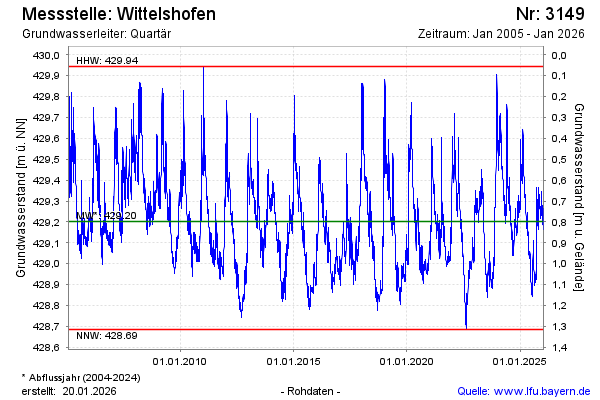
Chart of total period Wittelshofen
Groundwater level [m above sealevel]: 428.81
Distance to surface [m]: 1.19
Last value from 15.07.2026 01:00
Ground level [m above sealevel]: 430.00
| Date | Groundwater level [m above sealevel] |
|---|---|
| 14.07.2026 | 428.82 |
| 13.07.2026 | 428.82 |
| 12.07.2026 | 428.82 |
| 11.07.2026 | 428.83 |
| 10.07.2026 | 428.84 |
| 09.07.2026 | 428.85 |
| 08.07.2026 | 428.85 |
| 07.07.2026 | 428.86 |