
- Start >
- Groundwater >
- Waterlevel of upper layer >
- Obere Donau >
- WEMDING, BHF. 49 >
- Chart of total period

Chart of total period WEMDING, BHF. 49
Groundwater levels of the total period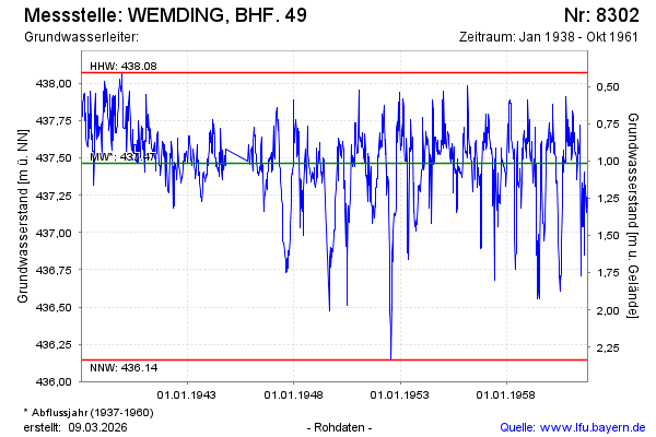
Groundwater level [m above sealevel]: 437.19
Distance to surface [m]: 1.29
Last value from 30.10.1961 12:00
Ground level [m above sealevel]: 438.48
| Date | Groundwater level [m above sealevel] |
|---|---|
| 23.10.1961 | 437.17 |
| 16.10.1961 | 437.23 |
| 09.10.1961 | 437.24 |
| 02.10.1961 | 437.23 |
| 25.09.1961 | 437.13 |
| 18.09.1961 | 437.29 |
| 11.09.1961 | 437.32 |
| 04.09.1961 | 437.14 |
© Bayerisches Landesamt für Umwelt 2026