
- Start >
- Groundwater >
- Waterlevel of upper layer >
- Obere Donau >
- WASSERZELL 37B >
- Chart of total period

Chart of total period WASSERZELL 37B
Groundwater levels of the total period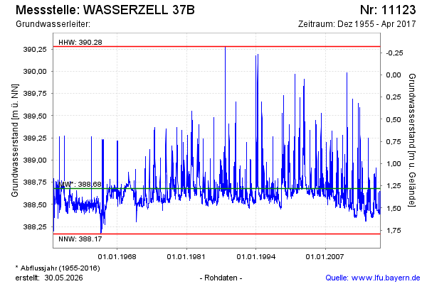
Groundwater level [m above sealevel]: 388.40
Distance to surface [m]: 1.56
Last value from 24.04.2017 09:11
Ground level [m above sealevel]: 389.96
| Date | Groundwater level [m above sealevel] |
|---|---|
| 24.04.2017 | 388.39 |
| 23.04.2017 | 388.41 |
| 22.04.2017 | 388.42 |
| 21.04.2017 | 388.42 |
| 20.04.2017 | 388.42 |
| 19.04.2017 | 388.42 |
| 18.04.2017 | 388.41 |
| 17.04.2017 | 388.39 |
© Bayerisches Landesamt für Umwelt 2026