
Current data Wassertrüdingen HW GWM 2
Groundwater level [m above sealevel]: 419.55
Distance to surface [m]: 2.26
Last value from 15.01.2026 14:00
Ground level [m above sealevel]: 421.81
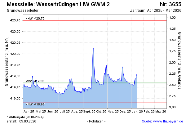
| Date | Groundwater level [m above sealevel] |
|---|---|
| 15.01.2026 | 419.54 |
| 14.01.2026 | 419.49 |
| 13.01.2026 | 419.41 |
| 12.01.2026 | 419.43 |
| 11.01.2026 | 419.45 |
| 10.01.2026 | 419.39 |
| 09.01.2026 | 419.31 |
| 08.01.2026 | 419.30 |