
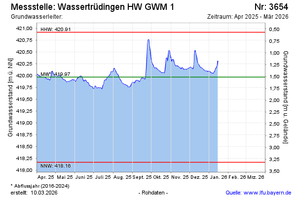
Current data Wassertrüdingen HW GWM 1
Groundwater level [m above sealevel]: 419.84
Distance to surface [m]: 1.68
Last value from 28.05.2026 11:12
Ground level [m above sealevel]: 421.52
| Date | Groundwater level [m above sealevel] |
|---|---|
| 28.05.2026 | 419.83 |
| 27.05.2026 | 419.83 |
| 26.05.2026 | 419.85 |
| 25.05.2026 | 419.85 |
| 24.05.2026 | 419.85 |
| 23.05.2026 | 419.85 |
| 22.05.2026 | 419.86 |
| 21.05.2026 | 419.85 |