
Current data Vötting
Groundwater level [m above sealevel]: 445.53
Distance to surface [m]: 1.14
Last value from 24.06.2026 13:00
Ground level [m above sealevel]: 446.67
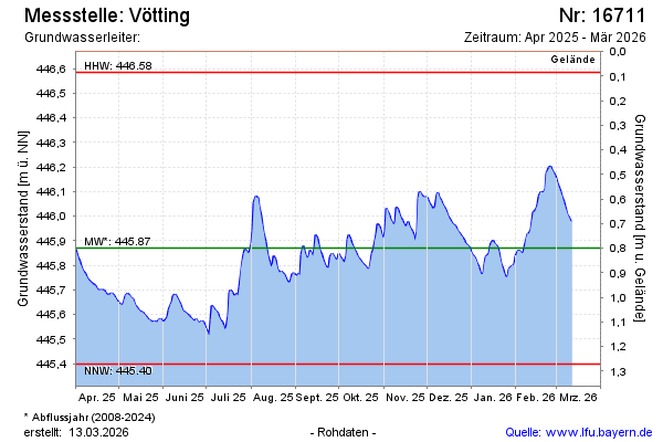
| Date | Groundwater level [m above sealevel] |
|---|---|
| 26.06.2026 | 445.51 |
| 25.06.2026 | 445.52 |
| 24.06.2026 | 445.53 |
| 23.06.2026 | 445.55 |
| 22.06.2026 | 445.56 |
| 21.06.2026 | 445.57 |
| 20.06.2026 | 445.58 |
| 19.06.2026 | 445.59 |