
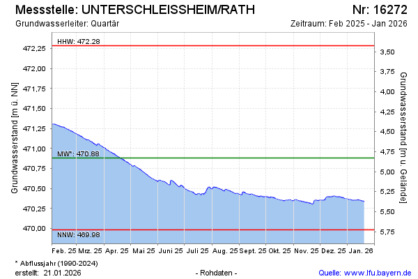
Current data UNTERSCHLEISSHEIM/RATH
Groundwater level [m above sealevel]: 470,24
Distance to surface [m]: 5,47
Last value from 22.07.2026 10:00
Ground level [m above sealevel]: 475.71
| Date | Groundwater level [m above sealevel] |
|---|---|
| 22.07.2026 | 470.24 |
| 21.07.2026 | 470.24 |
| 20.07.2026 | 470.25 |
| 19.07.2026 | 470.26 |
| 18.07.2026 | 470.27 |
| 17.07.2026 | 470.27 |
| 16.07.2026 | 470.28 |
| 15.07.2026 | 470.28 |