
- Start >
- Groundwater >
- Waterlevel of upper layer >
- Obere Donau >
- UNTEREMMENDORF 693 >
- Chart of total period

Chart of total period UNTEREMMENDORF 693
Groundwater levels of the total period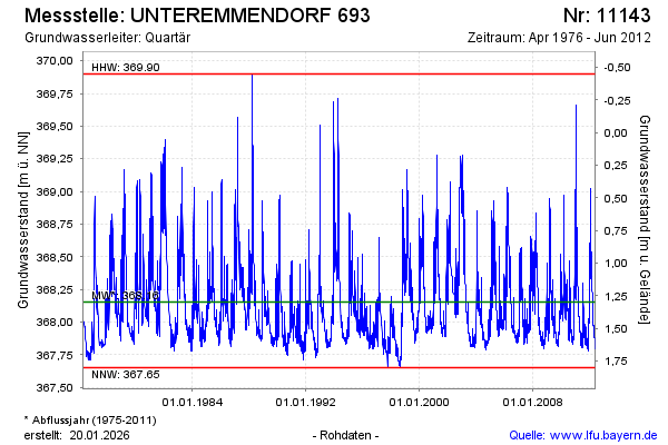
Groundwater level [m above sealevel]: 367.80
Distance to surface [m]: 1.65
Last value from 01.06.2012 01:00
Ground level [m above sealevel]: 369.45
| Date | Groundwater level [m above sealevel] |
|---|---|
| 01.06.2012 | 367.80 |
| 31.05.2012 | 367.80 |
| 30.05.2012 | 367.79 |
| 29.05.2012 | 367.80 |
| 28.05.2012 | 367.81 |
| 27.05.2012 | 367.81 |
| 26.05.2012 | 367.81 |
| 25.05.2012 | 367.81 |
© Bayerisches Landesamt für Umwelt 2026