
- Start >
- Groundwater >
- Waterlevel of upper layer >
- Obere Donau >
- TODTENWEIS 738 >
- Chart of total period

Chart of total period TODTENWEIS 738
Groundwater levels of the total period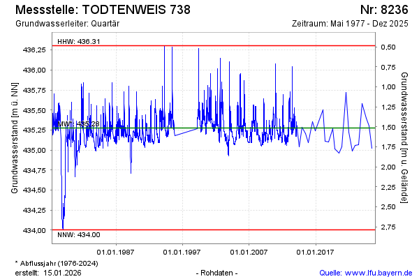
Groundwater level [m above sealevel]: 435.15
Distance to surface [m]: 1.64
Last value from 16.12.2025 10:00
Ground level [m above sealevel]: 436.79
| Date | Groundwater level [m above sealevel] |
|---|---|
| 04.06.2025 | 435.02 |
| 03.06.2025 | 435.02 |
| 05.12.2024 | 435.30 |
| 05.07.2024 | 435.40 |
| 18.12.2023 | 435.58 |
| 14.06.2023 | 435.07 |
| 30.11.2022 | 435.06 |
| 20.06.2022 | 434.99 |
© Bayerisches Landesamt für Umwelt 2026