
- Start >
- Groundwater >
- Waterlevel of upper layer >
- Obere Donau >
- Thal, Prielweg >
- Chart of total period

Chart of total period Thal, Prielweg
Groundwater levels of the total period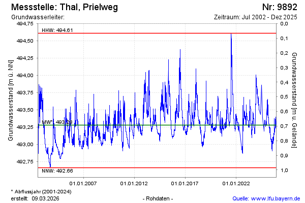
Groundwater level [m above sealevel]: 493.48
Distance to surface [m]:
Last value from 09.04.2024 12:58
Ground level [m above sealevel]: --
| Date | Groundwater level [m above sealevel] |
|---|---|
| 05.04.2024 | 493.51 |
| 04.04.2024 | 493.51 |
| 03.04.2024 | 493.51 |
| 02.04.2024 | 493.51 |
| 01.04.2024 | 493.52 |
| 31.03.2024 | 493.53 |
| 30.03.2024 | 493.53 |
| 29.03.2024 | 493.54 |
© Bayerisches Landesamt für Umwelt 2024