
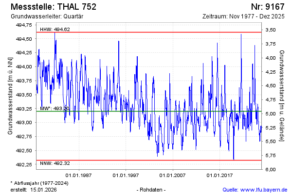
Chart of total period THAL 752
Groundwater level [m above sealevel]: 492,77
Distance to surface [m]: 5,39
Last value from 15.06.2026 09:03
Ground level [m above sealevel]: 498.16
| Date | Groundwater level [m above sealevel] |
|---|---|
| 15.06.2026 | 492.77 |
| 14.06.2026 | 492.78 |
| 13.06.2026 | 492.78 |
| 12.06.2026 | 492.78 |
| 11.06.2026 | 492.78 |
| 10.06.2026 | 492.79 |
| 09.06.2026 | 492.79 |
| 08.06.2026 | 492.79 |