
- Start >
- Groundwater >
- Waterlevel of upper layer >
- Obere Donau >
- STENGELHEIM 24.1 >
- Chart of total period

Chart of total period STENGELHEIM 24.1
Groundwater levels of the total period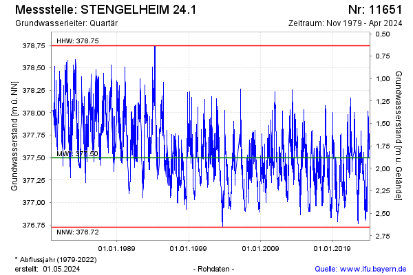
Groundwater level [m above sealevel]: 377.47
Distance to surface [m]: 1.91
Last value from 01.04.2026 15:00
Ground level [m above sealevel]: 379.38
| Date | Groundwater level [m above sealevel] |
|---|---|
| 01.04.2026 | 377.47 |
| 31.03.2026 | 377.48 |
| 30.03.2026 | 377.47 |
| 29.03.2026 | 377.47 |
| 28.03.2026 | 377.46 |
| 27.03.2026 | 377.47 |
| 26.03.2026 | 377.49 |
| 25.03.2026 | 377.49 |
© Bayerisches Landesamt für Umwelt 2026