
- Start >
- Groundwater >
- Waterlevel of upper layer >
- Obere Donau >
- SONDERHEIM P 5 >
- Chart of total period

Chart of total period SONDERHEIM P 5
Groundwater levels of the total period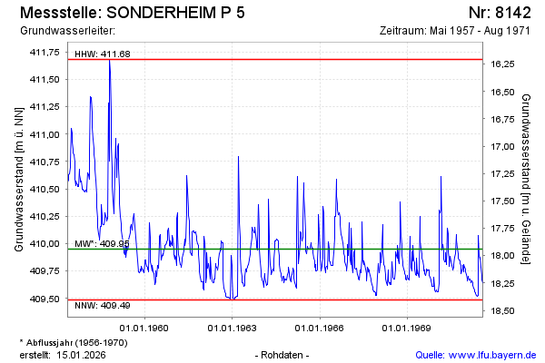
Groundwater level [m above sealevel]: 409.62
Distance to surface [m]: 18.27
Last value from 08.08.1971 12:00
Ground level [m above sealevel]: 427.89
| Date | Groundwater level [m above sealevel] |
|---|---|
| 01.08.1971 | 409.64 |
| 25.07.1971 | 409.67 |
| 18.07.1971 | 409.71 |
| 11.07.1971 | 409.78 |
| 04.07.1971 | 409.88 |
| 27.06.1971 | 409.86 |
| 20.06.1971 | 409.89 |
| 13.06.1971 | 410.08 |
© Bayerisches Landesamt für Umwelt 2026