
- Start >
- Groundwater >
- Waterlevel of upper layer >
- Obere Donau >
- Schweitenkirchen tief >
- Chart of total period

Chart of total period Schweitenkirchen tief
Groundwater levels of the total period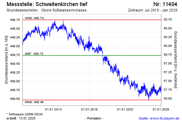
Groundwater level [m above sealevel]: 438.68
Distance to surface [m]: 57.83
Last value from 14.05.2024 10:00
Ground level [m above sealevel]: 496.51
| Date | Groundwater level [m above sealevel] |
|---|---|
| 14.05.2024 | 438.67 |
| 13.05.2024 | 438.65 |
| 12.05.2024 | 438.62 |
| 11.05.2024 | 438.59 |
| 10.05.2024 | 438.58 |
| 09.05.2024 | 438.59 |
| 08.05.2024 | 438.62 |
| 07.05.2024 | 438.66 |
© Bayerisches Landesamt für Umwelt 2024