
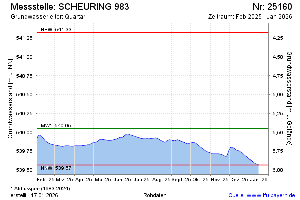
Current data SCHEURING 983
Groundwater level [m above sealevel]: 539.93
Distance to surface [m]: 5.5700000000001
Last value from 24.06.2026 05:00
Ground level [m above sealevel]: 545.50
| Date | Groundwater level [m above sealevel] |
|---|---|
| 24.06.2026 | 539.93 |
| 23.06.2026 | 539.93 |
| 22.06.2026 | 539.92 |
| 21.06.2026 | 539.93 |
| 20.06.2026 | 539.93 |
| 19.06.2026 | 539.93 |
| 18.06.2026 | 539.93 |
| 17.06.2026 | 539.93 |