
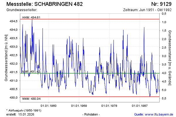
Chart of total period SCHABRINGEN 482
Groundwater level [m above sealevel]: 430,25
Distance to surface [m]: 5,19
Last value from 26.10.1992 12:00
Ground level [m above sealevel]: 435.44
| Date | Groundwater level [m above sealevel] |
|---|---|
| 19.10.1992 | 430.25 |
| 12.10.1992 | 430.30 |
| 05.10.1992 | 430.32 |
| 28.09.1992 | 430.32 |
| 21.09.1992 | 430.35 |
| 14.09.1992 | 430.38 |
| 07.09.1992 | 430.40 |
| 31.08.1992 | 430.44 |