
Current data Rohrbach GW4
Groundwater level [m above sealevel]: 394.93
Distance to surface [m]: 2.38
Last value from 13.11.2025 11:20
Ground level [m above sealevel]: 397.31
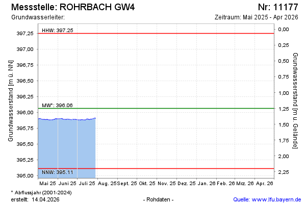
| Date | Groundwater level [m above sealevel] |
|---|---|
| 29.07.2025 | 395.90 |
| 28.07.2025 | 395.91 |
| 27.07.2025 | 395.91 |
| 26.07.2025 | 395.90 |
| 25.07.2025 | 395.89 |
| 24.07.2025 | 395.90 |
| 23.07.2025 | 395.89 |
| 22.07.2025 | 395.89 |