
- Start >
- Groundwater >
- Waterlevel of upper layer >
- Obere Donau >
- RIEDENSHEIM BS13 >
- Chart of total period

Chart of total period RIEDENSHEIM BS13
Groundwater levels of the total period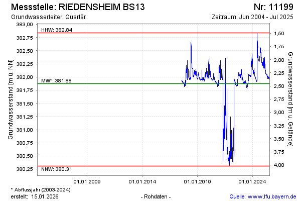
Groundwater level [m above sealevel]: 382.30
Distance to surface [m]: 2.03
Last value from 12.11.2025 12:46
Ground level [m above sealevel]: 384.33
| Date | Groundwater level [m above sealevel] |
|---|---|
| 29.07.2025 | 382.09 |
| 10.07.2025 | 381.99 |
| 09.07.2025 | 381.98 |
| 08.07.2025 | 381.98 |
| 07.07.2025 | 381.97 |
| 06.07.2025 | 381.96 |
| 05.07.2025 | 381.96 |
| 04.07.2025 | 381.96 |
© Bayerisches Landesamt für Umwelt 2026