
- Start >
- Groundwater >
- Waterlevel of upper layer >
- Obere Donau >
- Reichelsdorf B 5 >
- Chart of total period

Chart of total period Reichelsdorf B 5
Groundwater levels of the total period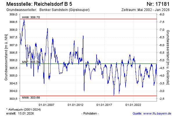
Groundwater level [m above sealevel]: 305.38
Distance to surface [m]: -4.38
Last value from 05.05.2024 09:00
Ground level [m above sealevel]: 301.00
| Date | Groundwater level [m above sealevel] |
|---|---|
| 05.05.2024 | 305.39 |
| 04.05.2024 | 305.38 |
| 03.05.2024 | 305.39 |
| 02.05.2024 | 305.43 |
| 01.05.2024 | 305.41 |
| 30.04.2024 | 305.36 |
| 29.04.2024 | 305.30 |
| 28.04.2024 | 305.28 |
© Bayerisches Landesamt für Umwelt 2024