
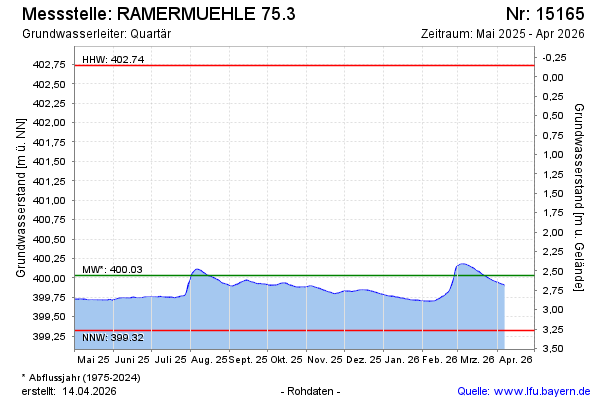
Current data RAMERMUEHLE 75.3
Groundwater level [m above sealevel]: 399.74
Distance to surface [m]: 2.85
Last value from 02.06.2026 09:25
Ground level [m above sealevel]: 402.59
| Date | Groundwater level [m above sealevel] |
|---|---|
| 02.06.2026 | 399.74 |
| 01.06.2026 | 399.74 |
| 31.05.2026 | 399.74 |
| 30.05.2026 | 399.74 |
| 29.05.2026 | 399.74 |
| 28.05.2026 | 399.75 |
| 27.05.2026 | 399.75 |
| 26.05.2026 | 399.75 |