
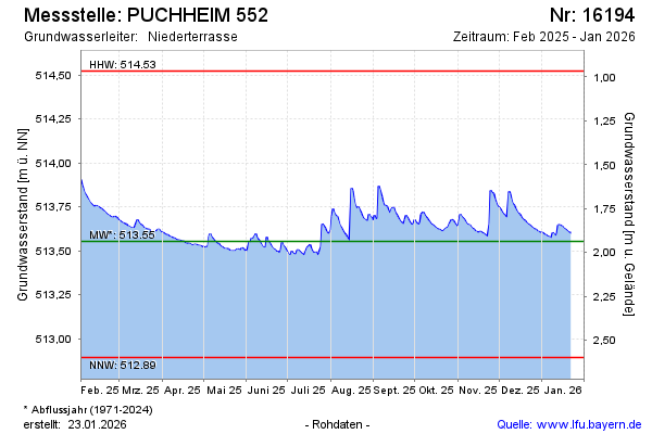
Current data PUCHHEIM 552
Groundwater level [m above sealevel]: 513.50
Distance to surface [m]: 1.99
Last value from 01.07.2026 10:00
Ground level [m above sealevel]: 515.49
| Date | Groundwater level [m above sealevel] |
|---|---|
| 01.07.2026 | 513.37 |
| 30.06.2026 | 513.36 |
| 29.06.2026 | 513.35 |
| 28.06.2026 | 513.35 |
| 27.06.2026 | 513.35 |
| 26.06.2026 | 513.36 |
| 25.06.2026 | 513.37 |
| 24.06.2026 | 513.37 |