
- Start >
- Groundwater >
- Waterlevel of upper layer >
- Obere Donau >
- NOERDL.ILLERZELL 1101 >
- Chart of total period

Chart of total period NOERDL.ILLERZELL 1101
Groundwater levels of the total period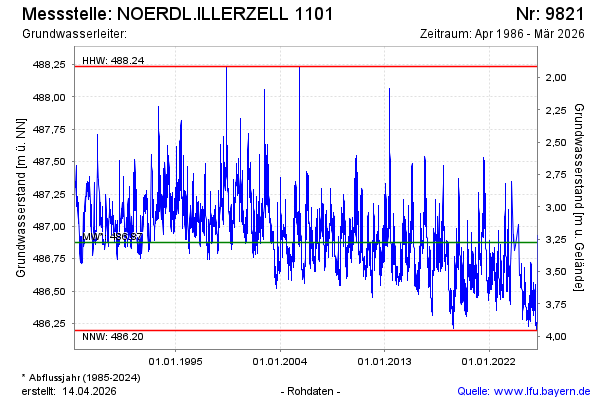
Groundwater level [m above sealevel]: 486.63
Distance to surface [m]: 3.52
Last value from 10.03.2026 13:56
Ground level [m above sealevel]: 490.15
| Date | Groundwater level [m above sealevel] |
|---|---|
| 10.03.2026 | 486.63 |
| 09.03.2026 | 486.65 |
| 08.03.2026 | 486.66 |
| 07.03.2026 | 486.68 |
| 06.03.2026 | 486.71 |
| 05.03.2026 | 486.73 |
| 04.03.2026 | 486.76 |
| 03.03.2026 | 486.79 |
© Bayerisches Landesamt für Umwelt 2026