
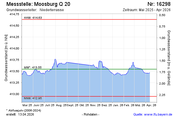
Current data Moosburg Q 20
Groundwater level [m above sealevel]: 413.42
Distance to surface [m]: 1.81
Last value from 13.07.2026 09:00
Ground level [m above sealevel]: 415.23
| Date | Groundwater level [m above sealevel] |
|---|---|
| 13.07.2026 | 413.42 |
| 12.07.2026 | 413.42 |
| 11.07.2026 | 413.43 |
| 10.07.2026 | 413.43 |
| 09.07.2026 | 413.44 |
| 08.07.2026 | 413.45 |
| 07.07.2026 | 413.46 |
| 06.07.2026 | 413.46 |