
- Start >
- Groundwater >
- Waterlevel of upper layer >
- Obere Donau >
- MOERSLINGEN D 44 >
- Chart of total period

Chart of total period MOERSLINGEN D 44
Groundwater levels of the total period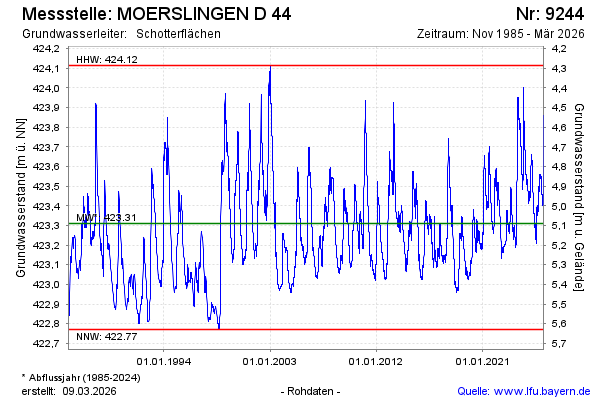
Groundwater level [m above sealevel]: 423.44
Distance to surface [m]: 4.96
Last value from 10.05.2026 10:00
Ground level [m above sealevel]: 428.40
| Date | Groundwater level [m above sealevel] |
|---|---|
| 10.05.2026 | 423.44 |
| 09.05.2026 | 423.45 |
| 08.05.2026 | 423.45 |
| 07.05.2026 | 423.46 |
| 06.05.2026 | 423.46 |
| 05.05.2026 | 423.47 |
| 04.05.2026 | 423.47 |
| 03.05.2026 | 423.48 |
© Bayerisches Landesamt für Umwelt 2026