
- Start >
- Groundwater >
- Waterlevel of upper layer >
- Obere Donau >
- MITTELSTETTEN 110 >
- Chart of total period

Chart of total period MITTELSTETTEN 110
Groundwater levels of the total period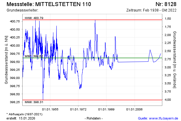
Groundwater level [m above sealevel]: 399.95
Distance to surface [m]: 2.38
Last value from 11.10.2022 10:00
Ground level [m above sealevel]: 402.33
| Date | Groundwater level [m above sealevel] |
|---|---|
| 05.10.2021 | 399.75 |
| 13.10.2020 | 399.60 |
| 26.09.2019 | 399.56 |
| 19.09.2018 | 399.50 |
| 22.05.2017 | 399.48 |
| 21.09.2016 | 399.65 |
| 18.06.2015 | 399.87 |
| 12.11.2014 | 399.70 |
© Bayerisches Landesamt für Umwelt 2026