
Current data Mitteldachstetten-Dörflein
Groundwater level [m above sealevel]: 419.35
Distance to surface [m]: 10.19
Last value from 24.06.2026 13:00
Ground level [m above sealevel]: 429.54
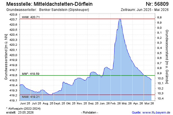
| Date | Groundwater level [m above sealevel] |
|---|---|
| 28.06.2026 | 419.32 |
| 27.06.2026 | 419.33 |
| 26.06.2026 | 419.34 |
| 25.06.2026 | 419.35 |
| 24.06.2026 | 419.35 |
| 23.06.2026 | 419.36 |
| 22.06.2026 | 419.36 |
| 21.06.2026 | 419.36 |