
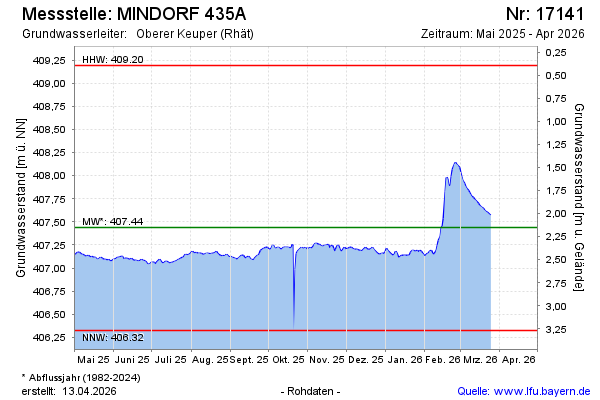
Current data MINDORF 435A
Groundwater level [m above sealevel]: 407.12
Distance to surface [m]: 2.47
Last value from 17.06.2026 10:45
Ground level [m above sealevel]: 409.59
| Date | Groundwater level [m above sealevel] |
|---|---|
| 17.06.2026 | 407.14 |
| 16.06.2026 | 407.14 |
| 15.06.2026 | 407.13 |
| 14.06.2026 | 407.14 |
| 13.06.2026 | 407.14 |
| 12.06.2026 | 407.15 |
| 11.06.2026 | 407.13 |
| 10.06.2026 | 407.13 |