
- Start >
- Groundwater >
- Waterlevel of upper layer >
- Obere Donau >
- Mertingen GWM 001 >
- Current data

Current data Mertingen GWM 001
Groundwater levels of the last 12 months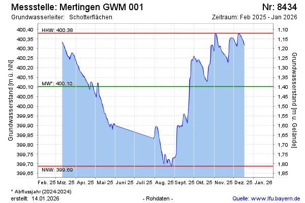
Groundwater level [m above sealevel]: 400.04
Distance to surface [m]: 1.46
Last value from 13.05.2026 07:18
Ground level [m above sealevel]: 401.50
| Date | Groundwater level [m above sealevel] |
|---|---|
| 13.05.2026 | 400.05 |
| 12.05.2026 | 400.05 |
| 11.05.2026 | 400.04 |
| 10.05.2026 | 400.05 |
| 09.05.2026 | 400.06 |
| 08.05.2026 | 400.07 |
| 07.05.2026 | 400.07 |
| 06.05.2026 | 400.07 |
© Bayerisches Landesamt für Umwelt 2026