
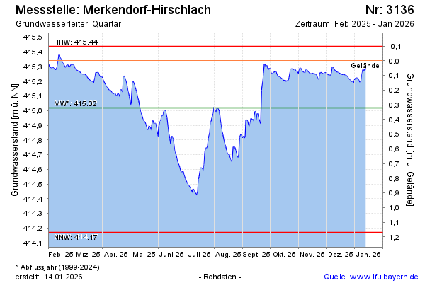
Current data Merkendorf-Hirschlach
Groundwater level [m above sealevel]: 414.55
Distance to surface [m]: 0.78999999999996
Last value from 14.07.2026 00:00
Ground level [m above sealevel]: 415.34
| Date | Groundwater level [m above sealevel] |
|---|---|
| 13.07.2026 | 414.55 |
| 12.07.2026 | 414.57 |
| 11.07.2026 | 414.60 |
| 10.07.2026 | 414.63 |
| 09.07.2026 | 414.66 |
| 08.07.2026 | 414.67 |
| 07.07.2026 | 414.70 |
| 06.07.2026 | 414.72 |