
- Start >
- Groundwater >
- Waterlevel of upper layer >
- Obere Donau >
- MERING 132 >
- Chart of total period

Chart of total period MERING 132
Groundwater levels of the total period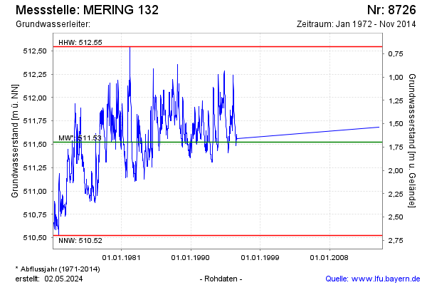
Groundwater level [m above sealevel]: 511.87
Distance to surface [m]: 1.35
Last value from 12.11.2014 10:00
Ground level [m above sealevel]: 513.22
| Date | Groundwater level [m above sealevel] |
|---|---|
| 07.05.2014 | 511.68 |
| 25.12.1995 | 511.56 |
| 18.12.1995 | 511.55 |
| 11.12.1995 | 511.59 |
| 04.12.1995 | 511.60 |
| 27.11.1995 | 511.61 |
| 20.11.1995 | 511.61 |
| 13.11.1995 | 511.48 |
© Bayerisches Landesamt für Umwelt 2026