
Chart of total period Manching HWS B2
Groundwater level [m above sealevel]: 360.71
Distance to surface [m]: 2.22
Last value from 11.06.2026 14:00
Ground level [m above sealevel]: 362.93
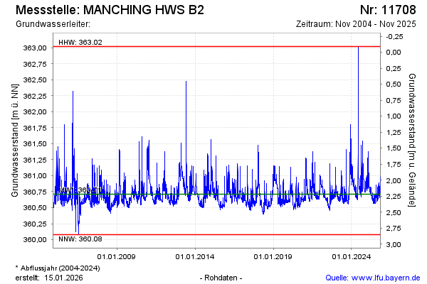
| Date | Groundwater level [m above sealevel] |
|---|---|
| 13.11.2025 | 360.76 |
| 12.11.2025 | 360.78 |
| 11.11.2025 | 360.80 |
| 10.11.2025 | 360.81 |
| 09.11.2025 | 360.78 |
| 08.11.2025 | 360.78 |
| 07.11.2025 | 360.81 |
| 06.11.2025 | 360.84 |