
- Start >
- Groundwater >
- Waterlevel of upper layer >
- Obere Donau >
- LUETZELBURG 7A >
- Chart of total period

Chart of total period LUETZELBURG 7A
Groundwater levels of the total period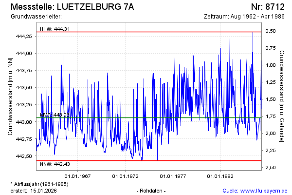
Groundwater level [m above sealevel]: 443.47
Distance to surface [m]: 1.36
Last value from 30.04.1986 12:00
Ground level [m above sealevel]: 444.83
| Date | Groundwater level [m above sealevel] |
|---|---|
| 23.04.1986 | 443.34 |
| 17.04.1986 | 443.20 |
| 10.04.1986 | 443.89 |
| 02.04.1986 | 443.68 |
| 26.03.1986 | 443.78 |
| 20.03.1986 | 443.32 |
| 10.03.1986 | 443.35 |
| 05.03.1986 | 443.31 |
© Bayerisches Landesamt für Umwelt 2026