
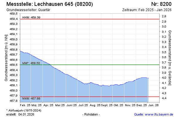
Current data LECHHAUSEN 645
Groundwater level [m above sealevel]: 458.14
Distance to surface [m]: 4.11
Last value from 01.07.2026 14:00
Ground level [m above sealevel]: 462.25
| Date | Groundwater level [m above sealevel] |
|---|---|
| 01.07.2026 | 458.14 |
| 30.06.2026 | 458.14 |
| 29.06.2026 | 458.15 |
| 28.06.2026 | 458.15 |
| 27.06.2026 | 458.16 |
| 26.06.2026 | 458.16 |
| 25.06.2026 | 458.17 |
| 24.06.2026 | 458.18 |