
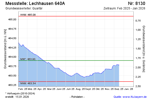
Current data Lechhausen 640 A
Groundwater level [m above sealevel]: 463.48
Distance to surface [m]: 2.24
Last value from 02.07.2026 12:08
Ground level [m above sealevel]: 465.72
| Date | Groundwater level [m above sealevel] |
|---|---|
| 02.07.2026 | 463.47 |
| 01.07.2026 | 463.46 |
| 30.06.2026 | 463.46 |
| 29.06.2026 | 463.47 |
| 28.06.2026 | 463.47 |
| 27.06.2026 | 463.49 |
| 26.06.2026 | 463.50 |
| 25.06.2026 | 463.51 |