
Current data Krumbach WWA
Groundwater level [m above sealevel]: 514.43
Distance to surface [m]: 3.1900000000001
Last value from 24.06.2026 12:00
Ground level [m above sealevel]: 517.62
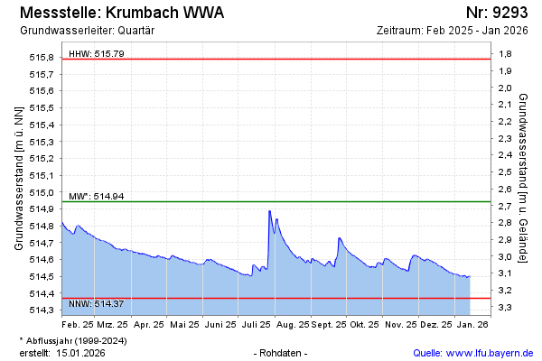
| Date | Groundwater level [m above sealevel] |
|---|---|
| 28.06.2026 | 514.41 |
| 27.06.2026 | 514.42 |
| 26.06.2026 | 514.42 |
| 25.06.2026 | 514.42 |
| 24.06.2026 | 514.43 |
| 23.06.2026 | 514.43 |
| 22.06.2026 | 514.44 |
| 21.06.2026 | 514.44 |