
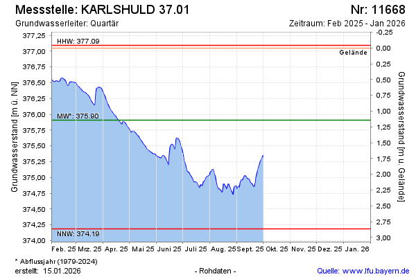
Current data KARLSHULD 37.01
Groundwater level [m above sealevel]: 376.15
Distance to surface [m]: 0.90000000000003
Last value from 01.04.2026 15:00
Ground level [m above sealevel]: 377.05
| Date | Groundwater level [m above sealevel] |
|---|---|
| 01.04.2026 | 376.15 |
| 31.03.2026 | 376.16 |
| 30.03.2026 | 376.16 |
| 29.03.2026 | 376.16 |
| 28.03.2026 | 376.16 |
| 27.03.2026 | 376.17 |
| 26.03.2026 | 376.19 |
| 25.03.2026 | 376.19 |